
Amazon - Website

 |
Project Gutenberg
Australia a treasure-trove of literature treasure found hidden with no evidence of ownership |
BROWSE the site for other works by this author (and our other authors) or SEARCH the entire site with Google Site Search |
![]() Home
Home
![]() Our FREE ebooks
Our FREE ebooks
![]() Search Site
Search Site
![]() Site Map
Site Map
![]() Contact Us
Contact Us
![]() Reading, Downloading and Converting files
Reading, Downloading and Converting files
Exploration Maps and Charts — Discovery of Australia by Land
[For Sea Expeditions, see Exploration Maps and Charts — Discovery of Australia by Sea]
Project Gutenberg of Australia gratefully acknowledges the contribution of Ned Overton
in re-designing and expanding the "Maps and Charts" page,
which is now a valuable resource when studying the discovery
and exploration of Australia, by land and sea, by non-indigenous people.
Part 1:
THE SLOW DISCOVERY
OF A VAST CONTINENT:
SUMMARY OF LAND EXPEDITIONS
(Click on the map to display an enlarged version.
For Discovery by Sea, see our other map
page).
The first part of
this page is intended to summarise the main
expeditions
of exploration described in core works. These include:
 Ernest Scott's "Australian
Discovery: [Vol. II] Discovery by Land" and
Ernest Scott's "Australian
Discovery: [Vol. II] Discovery by Land" and
"A Short History of Australia";
Ernest Favenc's
works, including "The History of Australian Exploration" and
"The Explorers of Australia and their Life-work".
 |
? |  |
|
Exploration of N.S.W., 1813-28; Evans to Cunningham |
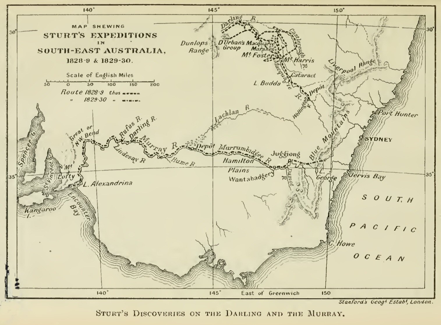
? | Sturt's Expeditions in S.E. Australia, 1828-30. |
 |
? |  |
|
Exploration extended; Eyre, the Gregorys and Burke and Wills (1840-61). |
? | Expeditions in W.A.: Grey, Forrest and Giles, 1836-74. |
?
Part 2:
TRACKS OF MAJOR EXPEDITIONS
IN THE DISCOVERY OF THE CONTINENT
(Click on the map to display an enlarged
version)
The central
part of this page is intended to outline the more important
individual expeditions overland, leading to a fuller
appreciation of the continent.
It also elucidates many works in PGA, including those by
or about:
Tench; Barralier; Blaxland et al.; Evans;
Oxley; Hume & Hovell; Cunningham; Sturt;
Mitchell; Eyre; Leichhardt; Kennedy;
The Gregorys; McDouall Stuart; Burke & Wills
Grey; The Forrests; Giles; Warburton,
among others.
See the table "Australian Land and Sea Explorers", on this
site [LINK].
NOTE: In a few of the earlier maps, west is up the
page,
before the adoption of the present convention.
 |
? |  |
|
Early Exploration around Sydney by Tench and Dawes, to ca. 1790. |
? | Barralier attempts to cross the Blue Mountains, 1802. |
 |
? |  |
|
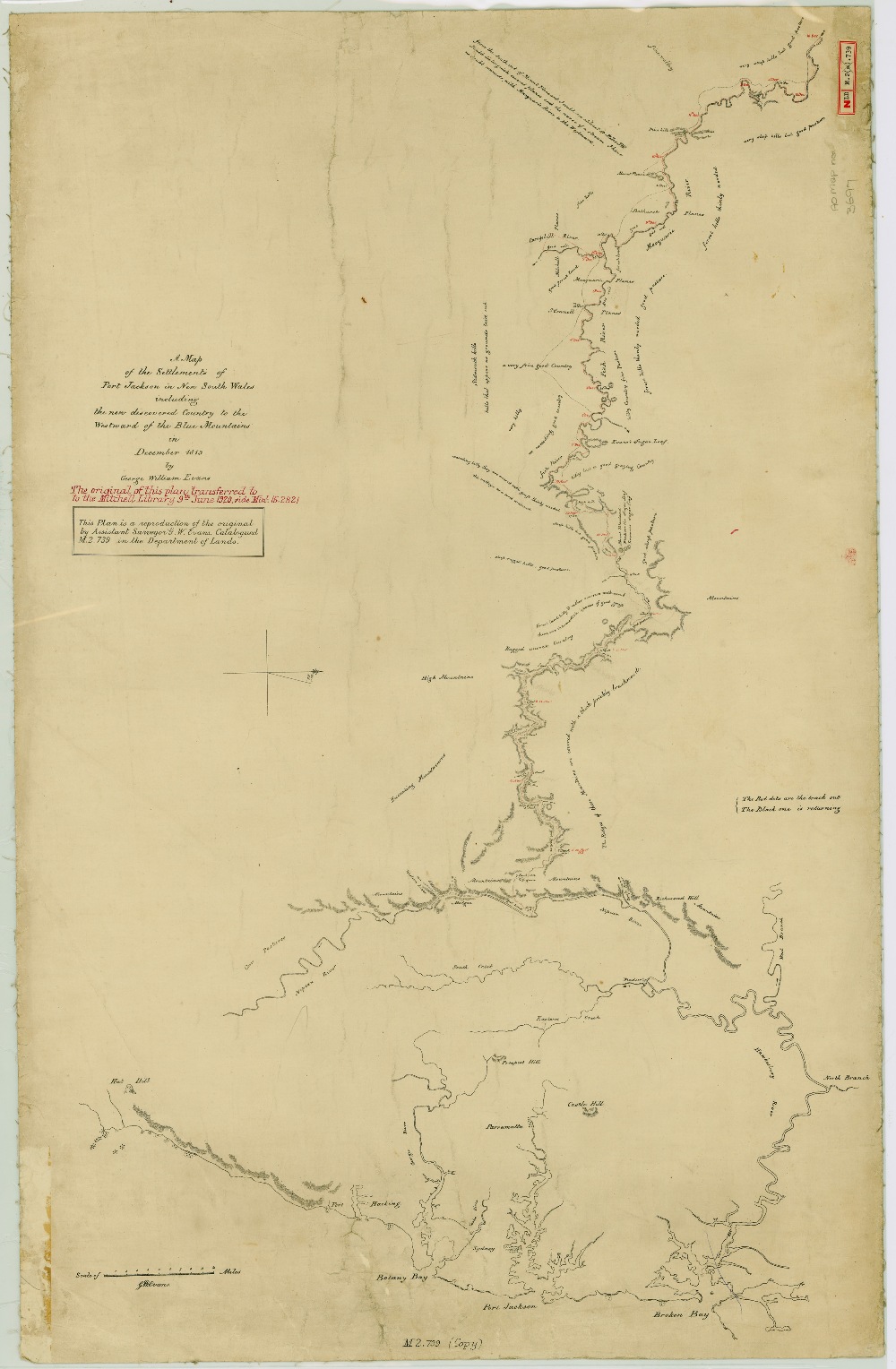
Evans follows the first route across the Blue Mountains, and examines the pastures beyond, 1813. |
? | A sketch of Evans's Journey to the Bathurst Plains, 1813. |
 |
? |  |
|
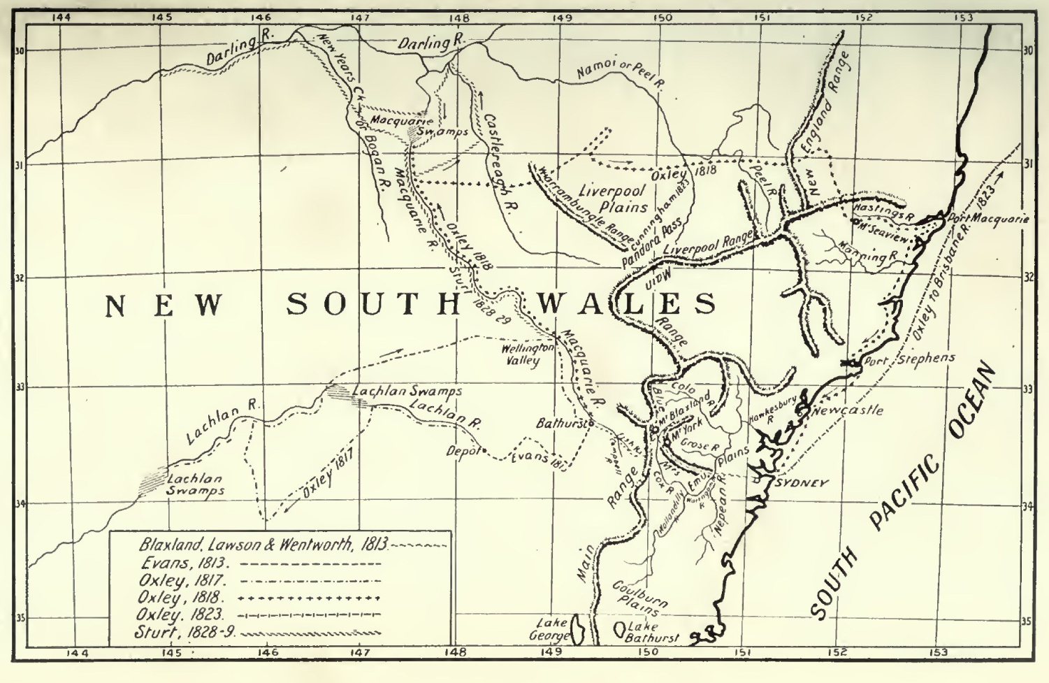
Includes Evans (1813), Oxley (1817-23) and Sturt (1828-9). |
? | Hume & Hovell, (1824), Sturt (1829-30) and Mitchell (1836). |
 |
? |  |
|
Edward John Eyre's route, east-to-west, 1840-1. |
? | Leichhardt (1844-5), Mitchell (1845-6) and Kennedy (1847 and 1848). |
 |
? |  |
|
Sturt's Expeditions into Central Australia, 1844-46. |
? | Crossing the Continent, South to North, 1858-62. |
 |
? |  |
|
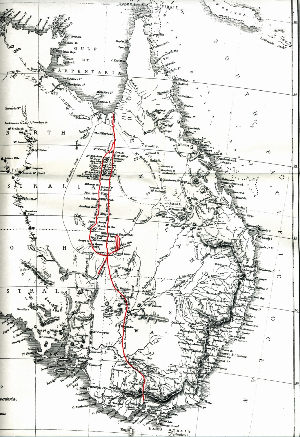
Burke & Wills's Fatal Track, 1860-1. |
? | John Forrest's Three Expeditions, 1869-74. |
 |
? |  |
|
Ernest Giles's Expeditions, 1872-76. |
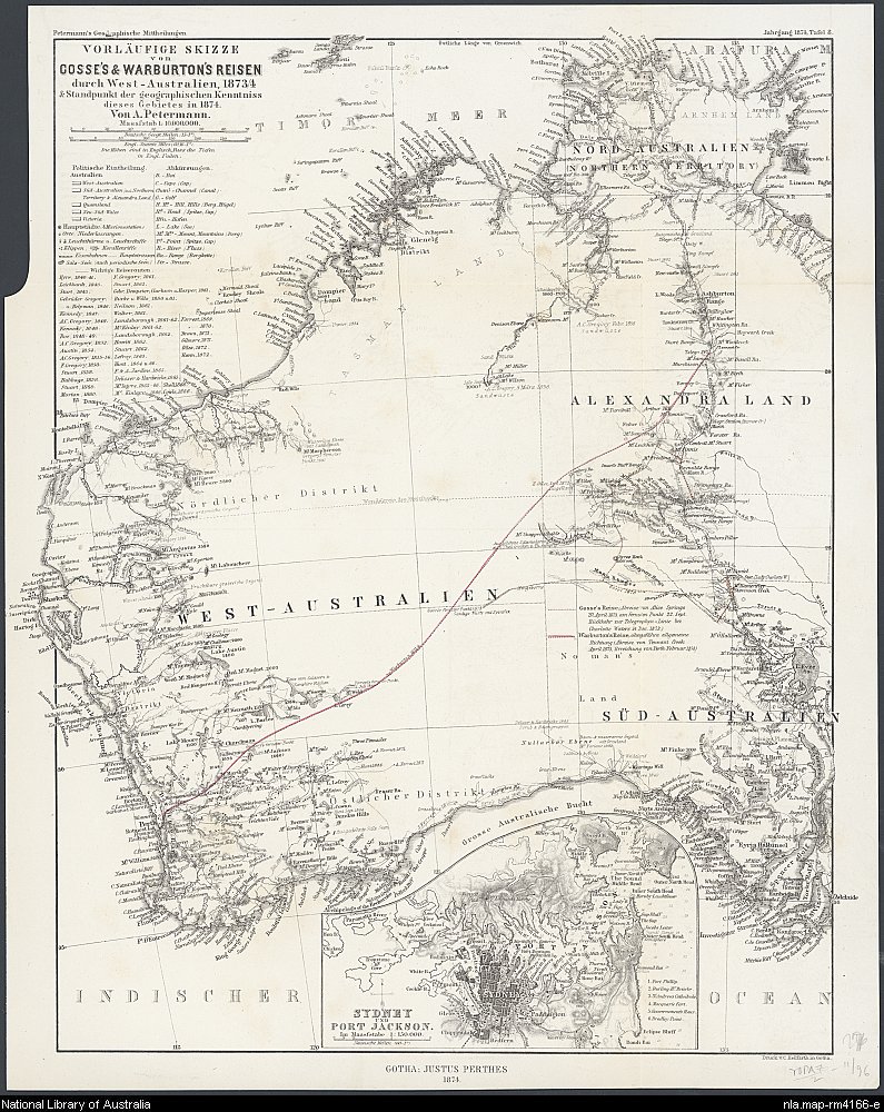
? | Expeditions by Warburton and Gosse, 1873-74. |
?
Part 3:
EARLY EXPLORATION OF ANTARCTICA
(Click on the map to display an enlarged
version)
This part of
the page more clearly illustrates maps in two PGA books:
Shackleton's
"Heart of the Antarctic", describing Shackleton's near miss at
reaching the South Pole, as well as Edgeworth David's and
Mawson's first journey to the South Magnetic Pole and the
first ascent of the active volcano, Mt Erebus; and
Amundsen's "The
South Pole", describing his conquest of the Pole in late
1912,
one month ahead of Robert Falcon Scott's party.
 |
? |  |
|
The continent of Antarctica, |
? | Shackleton's Furthest
South, 1908-9. |
 |
? |  |
|
Edgeworth David and Mawson reach the South Magnetic Pole, 1908-9. |
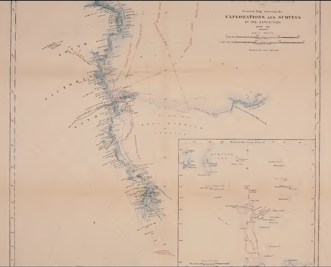
? | General Exploration in South Victoria Land, 1907-9. |
 |
? |  |
|
Amundsen reaches the South Pole, 1912, as reported in the press. |
? | Amundsen's Polar Journey, showing also Shackleton's track. |
?
Part 4:
THE GROWTH OF AUSTRALIA'S
EARLY MAJOR SETTLEMENTS
(Click on the map to display an enlarged
version)
The last part
of this page gives a few examples of maps of
some of Australia's major settlements, tracing their early
growth.
This is not intended as a specific reference tool, but gives a
flavour to
some of the works on Australia's early history found at PGA.
Maps will be added here from time to time.
 |
? |  |
|
Early map of Sydney Cove, |
? | Map of Sydney, by Dawes, July, 1788. |
 |
? |  |
|
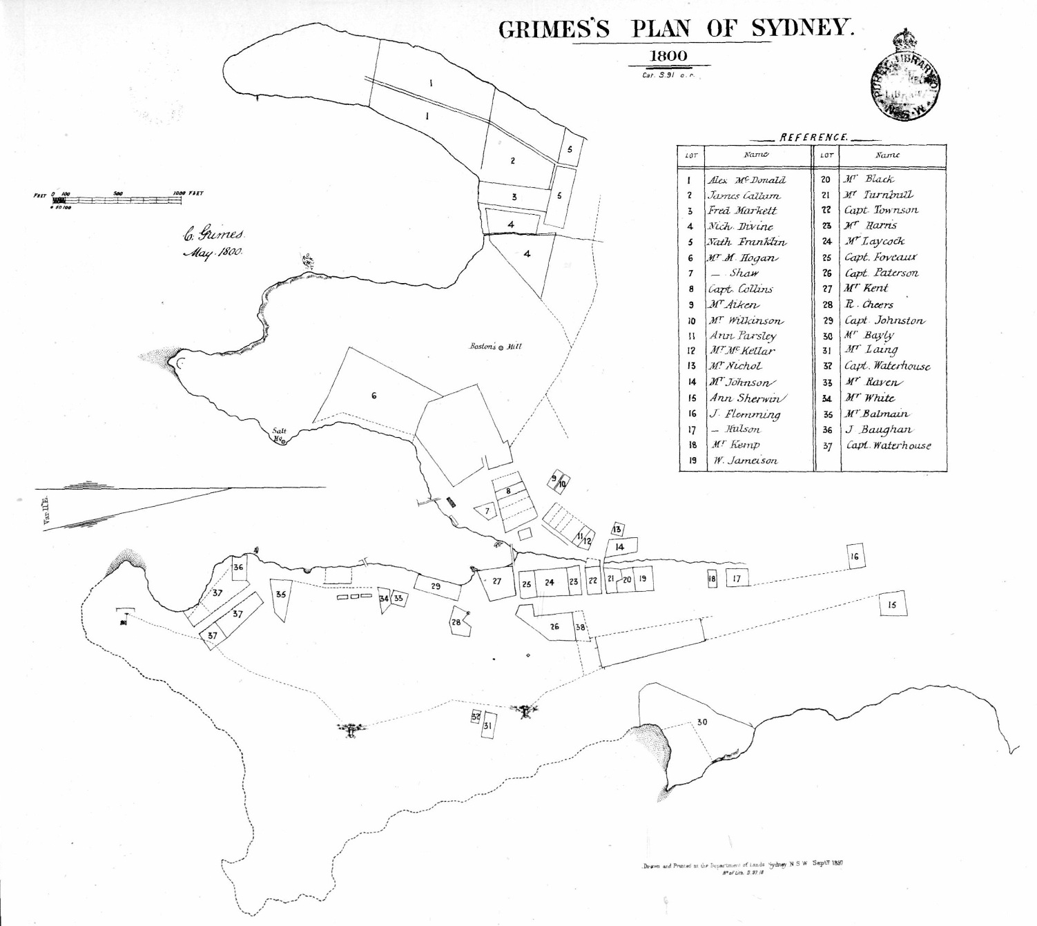
Sydney Cove by Surveyor-General Grimes, 1800. |
? | Sydney Cove, at the time of Baudin's visit, 1802. |
 |
? |  |
|
Sydney in Governor Bligh's Time, October, 1807. |
? | Sydney in Governor Darling's Time, ca. 1830. |
 |
? |  |
|
River Yarra and environs, mapped by Grimes, 1802-3. |
? | Early Melbourne, 1832. |
 |
? |  |
|
Tasmania's First Settlement: |
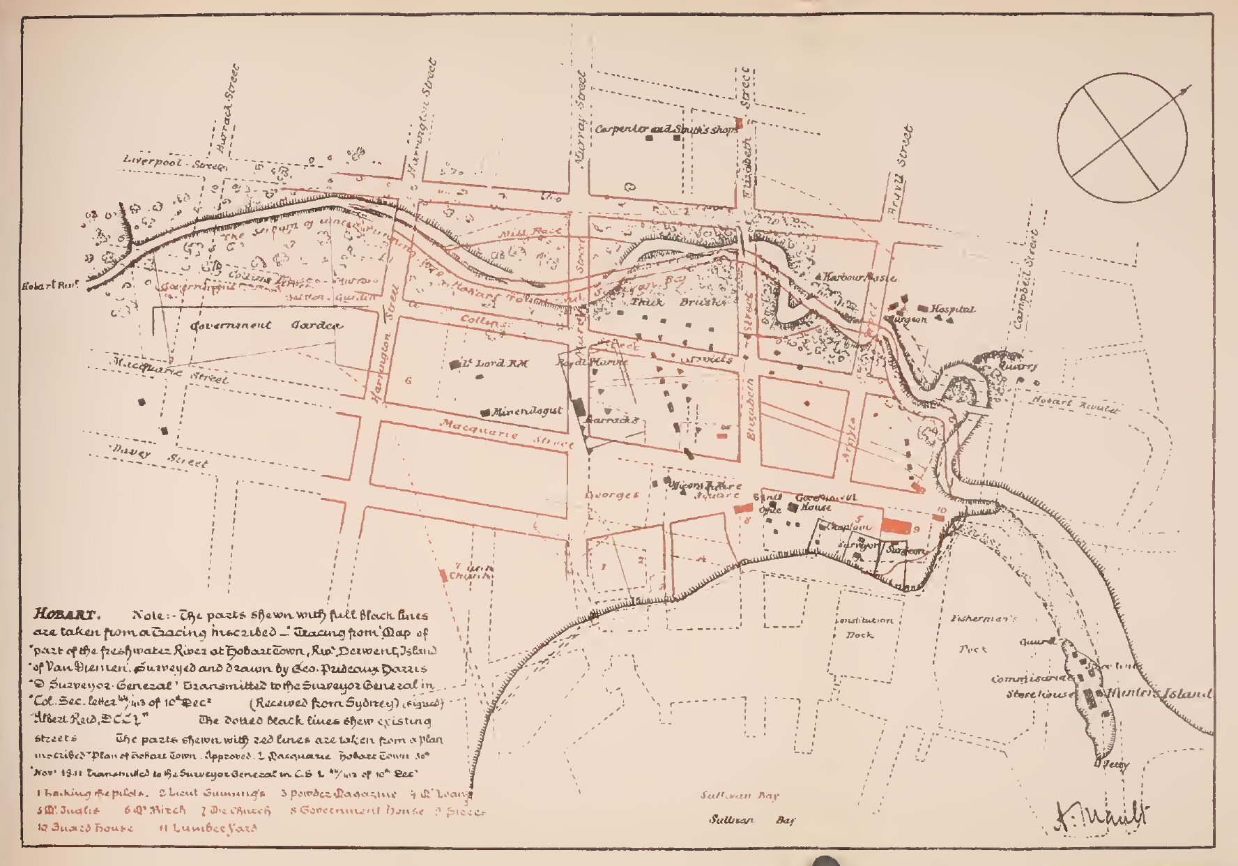
? | Early Hobart, 1804. [See Backhouse Walker] |
 |
? | _res1-1.jpg) |
|
Frankland's Map of Hobart, 1836-7. |
? | Jarman's Map of Hobart, 1858. |
 |
? |  |
|
The Swan River, as charted by Captain Stirling, 1827 |
? | Surveyor Milligan's map of Perth, 1845. |
?
Last Updated 14 Apr 2013