
File:Political Regions of Sudan, July 2010.svg
Size of this preview: 554 × 479 pixels.
| |
This is a file from the Wikimedia Commons. Information from its description page there is shown below.
Commons is a freely licensed media file repository. You can help. |
Summary
| Description |
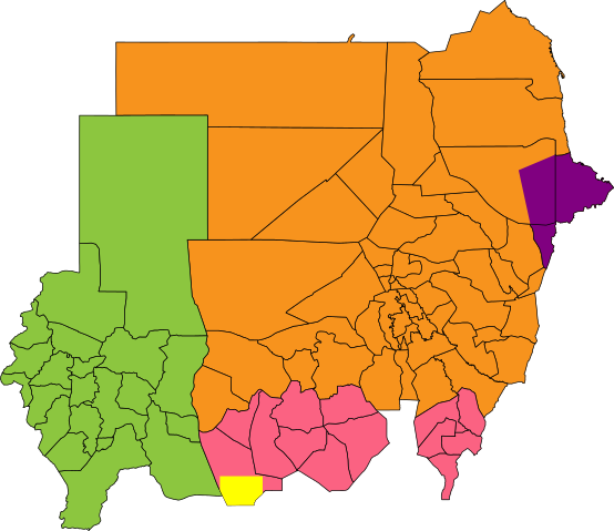
English: Map showing political regions of Sudan as of July 2006.
Darfur
Nuba Mountains and Blue Nile
North Sudan
Eastern Front, area of operations July 2006
Abyei, as defined by the Permanent Court of Arbitration
|
| Date | 9 July 2011 |
| Source |
|
| Author | Node ue |
Licensing
|
File usage
The following pages on Schools Wikipedia link to this image (list may be incomplete):
Metadata
Learn more about Schools Wikipedia
Schools Wikipedia was launched to make learning available to everyone. Thanks to SOS Childrens Villages, 62,000 children are enjoying a happy childhood, with a healthy, prosperous future ahead of them. You can help by sponsoring a child.