
Grafika:Cape Helles landing map.jpg
Z Wikipedii
Rozmiar podglądu: 789 × 599 pikseli
Obraz w wyższej rozdzielczości (845 × 642 pikseli, rozmiar pliku: 63 kB, typ MIME: image/jpeg)
| | Plik Cape Helles landing map.jpg [ edytuj opis ] umieszczony jest w Wikimedia Commons, repozytorium wolnych zasobów projektów Fundacji Wikimedia. Wyjaśnienie podanej poniżej licencji znajdziesz na stronie Opisy licencji grafiki. |
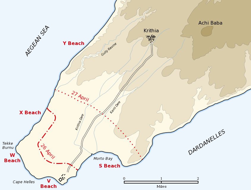
Map of the landing of the British 29th Division at Cape Helles on April 25, 1915 during the Battle of Gallipoli. The front line established by the night of April 26 is shown by the red dash-dot line. The front line reached by the night of April 27 is shown by the red dotted line. This became the "jumping off" line for the First Battle of Krithia.
| This image has been released into the public domain by its author, Gsl. This applies worldwide. In some countries this may not be legally possible; if so: العربية | Български | Deutsch | Ελληνικά | English | Español | Français | Italiano | 日本語 | 한국어 | Polski | Русский | Српски / Srpski | Svenska | தமிழ் | Українська | 中文(繁體) | 中文(简体) +/- |
Historia pliku
Kliknij na datę/czas, aby zobaczyć, jak plik wyglądał w tym czasie.
| Data/czas | Wymiary | Użytkownik | Opis | |
|---|---|---|---|---|
| aktualny | 17:04, 6 maj 2005 | 845×642 (63 kB) | Anathema | (Map of the landing of the British 29th Division at Cape Helles, Gallipoli, on April 25, 1915. The front line established by the night of April 26 is shown by the red dash-dot line. The front line reached by the night of April 27 is shown by the red ) |
Odnośniki do pliku
Następujące strony odwołują się do tego pliku:

